Thank you very much for visiting Gunter's Space Page. I hope that this site is useful and informative for you.
If you appreciate the information provided on this site, please consider supporting my work by making a simple and secure donation via PayPal. Please help to run the website and keep everything free of charge. Thank you very much.
Cartosat 2, 2A, 2B, 2C, 2D, 2E, 2F
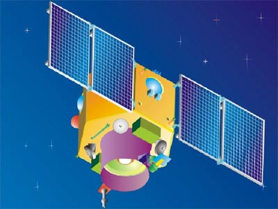
Cartosat 2 [ISRO]
Cartosat-2 is an advanced remote sensing satellite with a single panchromatic camera (PAN) capable of providing scene-specific spot imageries for cartographic applications. The camera is designed to provide imageries with better than one meter spatial resolution and a swath of 10 km. The satellite will have high agility with capability to steer along and across the track up to + 45 degrees. It will be placed in a sun-synchronous polar orbit at an altitude of 630 km. It will have a revisit period of four days. The re-visit can be improved to one day with suitable orbit manoeuvres.
Several new technologies like two mirror on axis single camera, Carbon Fabric Reinforced Plastic based electro optic structure, lightweight, large size mirrors, JPEG like data compression, advanced solid state recorder, high-torque reaction wheels and high performance star sensors are being employed in Cartosat-2.
Cartosat-2 suffered from some problems after launch. An improved Cartosat 2A was launched in 2008. Cartosat 2B followed in 2010.
Beginning with Cartosat 2C, a Multi-spectral camera was added and a lower 505 km orbit for better ground reslution was introduced.
Cartosat 2C was launched in June 2016. Cartosat 2D and Cartosat 2E followed in 2017 and Cartosat 2F was launched in January 2018.
| Nation: | India |
|---|---|
| Type / Application: | Earth observation |
| Operator: | ISRO |
| Contractors: | ISRO |
| Equipment: | Panchromatic Camera (PAN) (all); Multispectra camera (#2C, D, E) |
| Configuration: | IRS-2 Bus |
| Propulsion: | ? |
| Power: | 2 deployable solar arrays, batteries |
| Lifetime: | 5 years |
| Mass: | 650 kg (#2); 690 kg (#2A); 694 kg (#2B), 727 kg (#2C), 714 kg (#2D) |
| Orbit: | 630 km × 630 km, 97.9° (#2); 505 km × 505 km, 97.9° (#2C); 491 km × 508 km, 97.51° (#2D); 497 km × 518 km, 97.5° (#2E); 495 km × 510 km, 97.56° (#2F) |
References:
- ISRO: Cartosat 2
- ISRO: Cartosat 2A
- ISRO: Cartosat 2B