Thank you very much for visiting Gunter's Space Page. I hope that this site is useful and informative for you.
If you appreciate the information provided on this site, please consider supporting my work by making a simple and secure donation via PayPal. Please help to run the website and keep everything free of charge. Thank you very much.
Yaogan 34
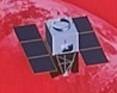
Yaogan 34
The Chinese Yaogan 34 (Remote Sensing Satellite-34) is the first of a series of government optical remote sensing satellites, likely also used as a military reconnaissance satellites.
It was described as an optical remote sensing satellite, mainly used in territorial survey, urban planning, land right confirmation, road network design, crop yield estimation, disaster prevention and mitigation and other fields, and can provide information guarantee for the construction of the "Belt and Road".
| Nation: | China |
|---|---|
| Type / Application: | Earth observation |
| Operator: | |
| Contractors: | SAST |
| Equipment: | |
| Configuration: | |
| Propulsion: | |
| Power: | Solar arrays, batteries |
| Lifetime: | |
| Mass: | |
| Orbit: | 1083 km × 1105 km, 63.38° |
| Satellite | COSPAR | Date | LS | Launch Vehicle | Remarks | |
|---|---|---|---|---|---|---|
| Yaogan 34 | 2021-037A | 30.04.2021 | Jq LC-43/94 | CZ-4C | ||
| Yaogan 34-02 | 2022-027A | 17.03.2022 | Jq LC-43/94 | CZ-4C | ||
| Yaogan 34-03 | 2022-154A | 15.11.2022 | Jq LC-43/94 | CZ-4C | ||
| Yaogan 34-04 | 2023-048A | 31.03.2023 | Jq LC-43/94 | CZ-4C |